Glau Standear Empire Story:Volume 1 Map: Difference between revisions
Jump to navigation
Jump to search
Created page with "image:GSEmpire v01 004.png Top: Overall Map of the Neyresia Continent *note typo in map, the continent is known as ネイレシア instead of レイネシア in rest of t..." |
mNo edit summary |
||
| Line 1: | Line 1: | ||
[[image:GSEmpire v01 004.png]] | [[image:GSEmpire v01 004.png]] | ||
Top: Overall Map of the Neyresia Continent | ==Top: Overall Map of the Neyresia Continent== | ||
*note typo in map, the continent is known as ネイレシア instead of レイネシア in rest of the text | *note typo in map, the continent is known as ネイレシア instead of レイネシア in rest of the text | ||
| Line 8: | Line 8: | ||
Center: Clemo Islands | Center: Clemo Islands | ||
Bottom | ==Bottom: Glau Standear Empire on left, Regia Theocracy on right== | ||
Legend | Legend | ||
Latest revision as of 04:18, 29 October 2015
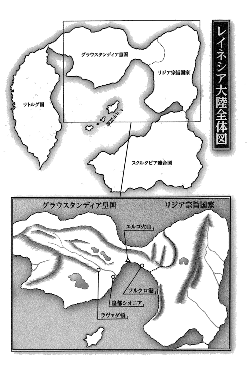
Top: Overall Map of the Neyresia Continent[edit]
- note typo in map, the continent is known as ネイレシア instead of レイネシア in rest of the text
Clockwise from west end: Nation of Latorg, Glau Standear Empire, Regia Theocracy, Allied Nations of Scrutabia
Center: Clemo Islands
Bottom: Glau Standear Empire on left, Regia Theocracy on right[edit]
Legend
- triangle: Elko Volcano
- circles: (left to right) Ravada Territory, Imperial Capital of Sionia, Port Frukro
| Back to Character Profiles | Return to Main Page | Forward to Prologue |
