File:Map1349.png
Jump to navigation
Jump to search
Size of this preview: 800 × 586 pixels. Other resolution: 1,189 × 871 pixels.
Original file (1,189 × 871 pixels, file size: 1.18 MB, MIME type: image/png)
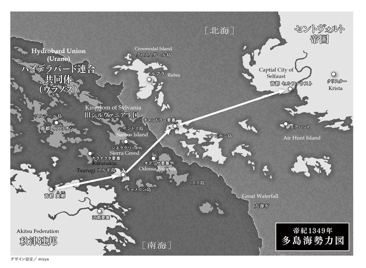
Map, Imperial Year 1349
File history
Click on a date/time to view the file as it appeared at that time.
| Date/Time | Thumbnail | Dimensions | User | Comment | |
|---|---|---|---|---|---|
| current | 08:59, 24 October 2024 | | 1,189 × 871 (1.18 MB) | QCore (talk | contribs) |
You cannot overwrite this file.
File usage
The following 2 pages use this file: